CES Las Vegas has become an important event even for car manufacturers. Toyota is going to take part to the show and wants to show everybody that it has developed a high-precision map generation system that will use data from on-board cameras and GPS devices installed in production vehicles.
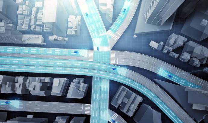
Toyota’s new system uses camera-equipped production vehicles to gather road images and vehicle positional information. This information is sent to data centers, where it is automatically pieced together, corrected and updated to generate high precision road maps that cover a wide area.
The information will be very important, as it will aid the implementation of automated driving. An understanding of road layouts and traffic rules (including speed limits and various road signs) is essential for this.
Toyota’s newly developed system uses automated cloud-based spatial information generation technology (developed by Toyota Central R&D Labs., Inc.) to generate high precision road image data from the databanks and GPS devices of designated user vehicles.
By utilizing production vehicles and existing infrastructure to collect information, this data can be updated in real time. Furthermore, the system can be implemented and scaled up at a relatively low cost.
To support the spread of automated driving technologies, Toyota plans to include this system as a core element in automated driving vehicles that will be made available in production vehicles by around 2020. While initial use of the system is expected to be limited to expressways, future development goals include expanding functionality to cover ordinary roads and assist in hazard avoidance.